|
MapCatalog | Order | Support | SiteIndex | Contact | Home | ||||||||||
|
|
|
|
|
|
|
|||||||||||
| N.America | 204 | |||||||||||||||

Mountain High Maps Catalog - USA
Map Specifications for USA
| Map identification: | 204 | Projection system: | Lambert's equal-area |
| Map coverage: | USA | North boundary: | 47° 00' N to 55° 00' N |
| Image size (pixels): | 3,785 x 2,418 pixels | South boundary: | 18° 00' N to 23° 00' N |
| Image size (inches): | 12.62 x 8.06 inches | East boundary: | 55° 00' to 65° 00' W |
| Image size (metric): | 321 x 205 millimeters | West boundary: | 130° 00' to 120° 00' W |
| Resolution per pixel: | 1,500 meters | Horizontal scale: | 1:10,000,000 |
| RGB file size: | 26.1 Mb | Vertical scale: | 1:328,333 |
| CMYK file size: | 34.9 Mb | Vertical interval: | 100 meters |
| Grayscale file size: | 8.7 Mb | Vertical exaggeration: | 30.5 times normal |
|
Countries, states and territories: |
Alabama, Arizona, Arkansas, California, Colorado, Connecticut, Delaware, Florida, Georgia, Idaho, Illinois, Indiana, Iowa, Kansas, Kentucky, Louisiana, Maine, Maryland, Massachusetts, Michigan, Minnesota, Mississippi, Missouri, Montana, Nebraska, Nevada, New Hampshire, New Jersey, New Mexico, New York, North Carolina, North Dakota, Ohio, Oklahoma, Oregon, Pennsylvania, Rhode Island, South Carolina, South Dakota, Tennessee, Texas, Utah, Vermont, Virginia, Washington DC, Washington, West Virginia, Wisconsin, Wyoming, Canada, Cuba, Mexico, USA, |
||
|
|
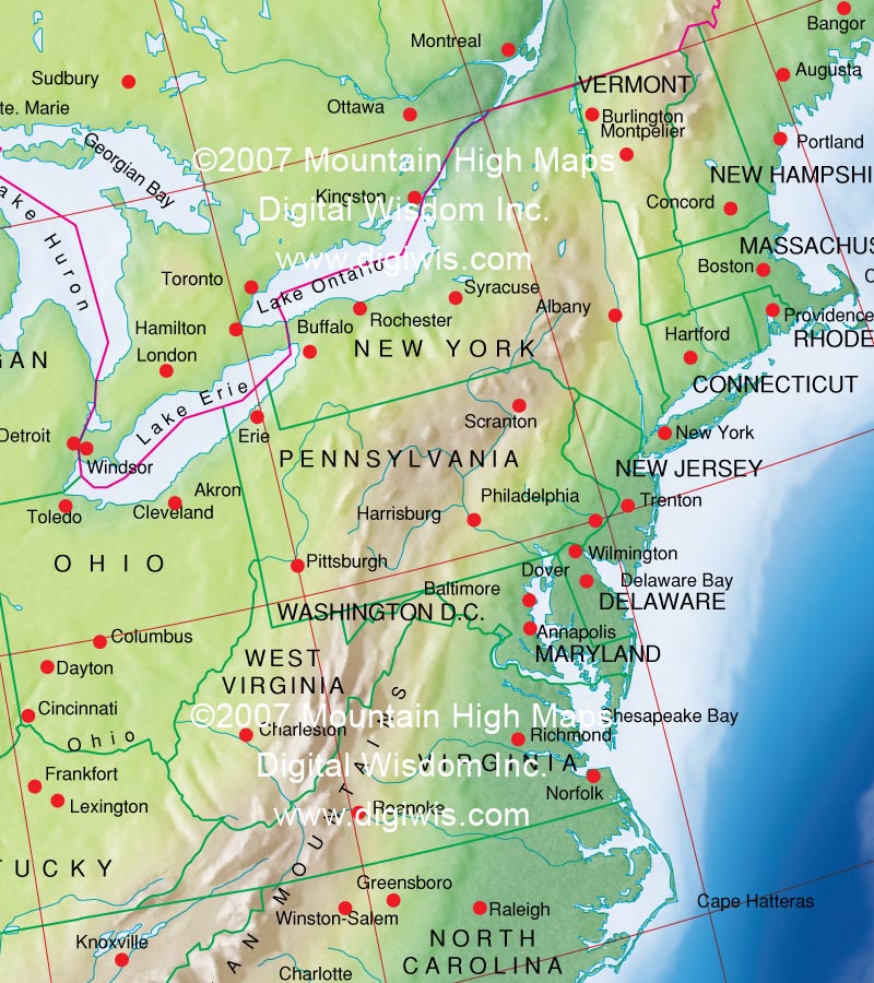
Example of the Mountain High Maps USA Illustrator Map #204 and Relief map This sample shows the Low Contrast Elevation style relief map placed in the bottom layer All states are individually layered and can be modified for fill color All map layers are editable in terms of line thickness, color, font sizes etc.. |
| USA Map #204 - Buying Options |
||||||||
|
USA Vector only EPS map (bottom left map image) |
USA Relief/Vector Map (all maps on this page) |
America Continent Relief/Vector 16 Map Package |
Mountain High Maps Relief/Vector 78 Map Package | |||||
Any comments or problems with this
site? Please
let us know
- thank you!
© Digital Wisdom, Inc.