|
MapCatalog | Order | Support | SiteIndex | Contact | Home | ||||||||||
|
|
|
|
|
|
|
|||||||||||
| S.America | 214 | |||||||||||||||

Mountain High Maps Catalog - South America, Northern half
Map Specifications for South America, Northern half
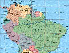
| Map identification: | 214 | Projection system: | Bipolar oblique |
| Map coverage: | South America, Northern half | North boundary: | 14° 00' N |
| Image size (pixels): | 2,571 x 1,976 pixels | South boundary: | 23° 27' S |
| Image size (inches): | 8.57 x 6.59 inches | East boundary: | 20° 00' W |
| Image size (metric): | 218 x 167 millimeters | West boundary: | 96° 00' W |
| Resolution per pixel: | 2,000 meters | Horizontal scale: | 1:5,000,000 |
| RGB file size: | 14.4 Mb | Vertical scale: | 1:328,333 |
| CMYK file size: | 19.3 Mb | Vertical interval: | 100 meters |
| Grayscale file size: | 4.8 Mb | Vertical exaggeration: | 15.2 times normal |
|
Countries, states and territories: |
Argentina, Bolivia, Brazil, Chile, Colombia, Ecuador, French Guiana, Guyana, Netherlands Antilles, Panama, Paraguay, Peru, Suriname, Trinidad & Tobago, Venezuela, |
||
|
| ||
|
| ||
|
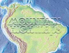
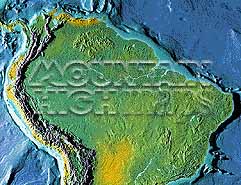
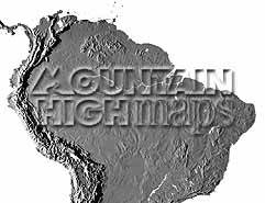
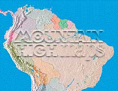
Top left: Elevation low-contrast relief rendering Top right: Vegetation high-contrast relief rendering Middle left: Grayscale land-only relief rendering Middle right: Political low-contrast relief rendering Lower right: Geo-political vector Illustrator EPS maps Inventory of maps and masks within each map portfolio
|
 |

| South America (North) Map #214 - Buying Options |
||||||||
|
South America (North) Vector only EPS map (bottom left map image) |
South America (North) Relief/Vector Map (all maps on this page) |
America Continent Relief/Vector 16 Map Package |
Mountain High Maps Relief/Vector 78 Map Package | |||||
Any comments or problems with this
site? Please
let us know - thank you!
© Digital Wisdom, Inc.