|
MapCatalog | Order | Support | SiteIndex | Contact | Home | ||||||||||
|
|
|
|
|
|
|
|||||||||||
| USDT | Tech Specs | For GIS | Download | US Relief | License | |||||||||||
|
MapCatalog | Order | Support | SiteIndex | Contact | Home | ||||||||||
|
|
|
|
|
|
|
|||||||||||
| USDT | Tech Specs | For GIS | Download | US Relief | License | |||||||||||
All maps images on this CD-ROM are TIFF format, RGB 24 bit color, and 72 dpi resolution, and readable by Mac or Win computers (price: $35). Resolution is expressed as the size of a pixel in terrain coverage.
The maps in this collection have been computed from the USGS 3 and 30 second elevation databases and from NOAA's 5 minute elevation database ETOPO-5.
| Map Coverage | Pixel Size | Resolution | File Size |
|---|---|---|---|
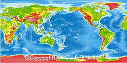
| World Map | 3513 x 1757 | 10,000 meters | 21 Mb |
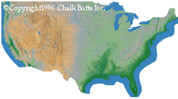
| USA Map | 4591 x 2496 | 1,000 meters | 35 Mb |
![]()
| Map Coverage | Pixel Size | Resolution | File Size |
|---|---|---|---|
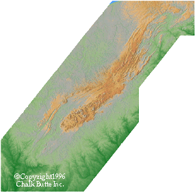
| USA - Appalachian Fold | 4841 x 4745 | 200 meters | 74 Mb |
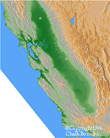
| USA - San Andreas fault | 2880 x 3600 | 200 meters | 30 Mb |
![]()
| Map Coverage | Pixel Size | Resolution | File Size |
|---|---|---|---|
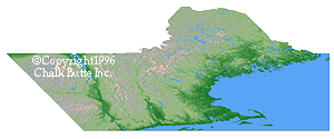
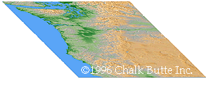
| USA - New England (Perspective) | 5023 x 1927 | 100 meters | 32 Mb |
| USA - Cascades (Perspective) | 4765 x 1807 | 125 meters | 30 Mb |
![]()
| Map Coverage | Pixel Size | Resolution | File Size |
|---|---|---|---|
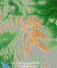
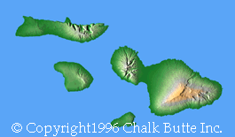
| USA - Rockies | 2983 x 3589 | 200 meters | 36 Mb |
| USA - Hawaii | 3525 x 2369 | 200 meters | 27 Mb |
![]()
| Map Coverage | Pixel Size | Resolution | File Size |
|---|---|---|---|
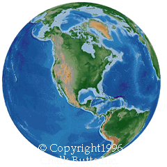
| Globe - Centered on USA | 1476 x 1476 | 8,000 meters | 6 Mb |
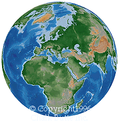
| Globe - Centered on Greece | 1476 x 1476 | 8,000 meters | 6 Mb |
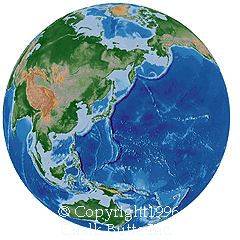
| Globe - Centered on Japan | 1476 x 1476 | 8,000 meters | 6 Mb |
Digital Maps ©Copyright 1996 Chalk Butte Inc.
![]()
Any comments or problems with this
site? Please
let us know
- thank you!
© Digital Wisdom, Inc.

