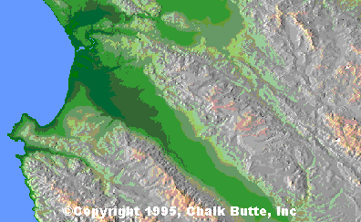
View a two full size sample US Digital Topography map. Each map
tile (or quadrangle) is one degree of latitude by one degree of
longitude. Each quadrangle is designated by the latitude and
longitude of the South-East corner - this sample is located
at 36° North / 121° West
and features the coastline and an area inland from Monterey and
Salinas, California. Your browser will transfer this image
in a few minutes, however, to manipulate the image you may also
use Adobe Photoshop or a similar image editor
that can open or import JPEG format images. The file is sized
at 1.1 Mbyte and will decompress to approx 2 Mbytes:
 Download US Digital Topo Sample Map.