|
MapCatalog | Order | Support | SiteIndex | Contact | Home | ||||||||||
|
|
|
|
|
|
|
|||||||||||
| World | Polar | 609 | ||||||||||||||

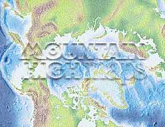
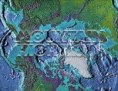
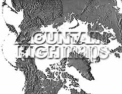
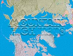
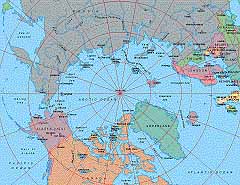
Mountain High Maps Catalog - Arctic Ocean centered on 90° West
Map Specifications for Arctic Ocean centered on 90° West
| Map identification: | 609 | Projection system: | Zenithal equidistant |
| Map coverage: | Arctic Ocean centered on 90° West | North boundary: | 59° 00' N |
| Image size (pixels): | 2,345 x 1,873 pixels | South boundary: | 59° 00' N |
| Image size (inches): | 7.82 x 6.24 inches | East boundary: | 50° 00' N |
| Image size (metric): | 199 x 158 millimeters | West boundary: | 50° 00' N |
| Resolution per pixel: | 3,500 meters | Horizontal scale: | 1:11,700,000 |
| RGB file size: | 12.6 Mb | Vertical scale: | 1:656,666 |
| CMYK file size: | 16.9 Mb | Vertical interval: | 200 meters |
| Grayscale file size: | 4.2 Mb | Vertical exaggeration: | 17.8 times normal |
|
Countries, states and territories: |
Alaska, Belorussia, Canada, Denmark, Estonia, Finland, Gemany, Greenland, Iceland, Ireland, Latvia, Lithuania, Moldovia, Netherlands, Norway, Poland, Russia, Sweden, Ukraine, United Kingdom, |
||
|
| ||
|
| ||
|
Top left: Elevation low-contrast relief rendering Top right: Vegetation high-contrast relief rendering Middle left: Grayscale land-only relief rendering Middle right: Political low-contrast relief rendering Lower right: Geo-political vector Illustrator EPS maps Inventory of maps and masks within each map portfolio
|
 |

| Arctic at 90° West Map #609 - Buying Options |
||||||||
|
Arctic at 90° West Vector only EPS map (bottom left map image) |
Arctic at 90° West Relief/Vector Map (all maps on this page) |
World Ocean Polar Relief/Vector 14 Map Package |
Mountain High Maps Relief/Vector 78 Map Package | |||||
Any comments or problems with this
site? Please
let us know
- thank you!
© Digital Wisdom, Inc.